
The Metra Map Guide: The definitive guide to Chicago’s commuter train system. It includes all 11 rail lines, each color-coded, along with end stations, intermediate stops, and major transfer points. The fare zones are also marked on the map, which provides riders with a way to look up ticket prices based on the distances they will travel. The Metra Map includes over 200 stations and is ideal for planning trips throughout Chicago (especially commuting from the suburbs to downtown). It assists riders in finding the best routes, connections to CTA and Pace services, and parking or accessible stations. The Metra Map can be found on the Metra website, on the app, and on board trains for convenient access.
Before planning a trip, check the latest Metra Train Hours and Metra tickets information.
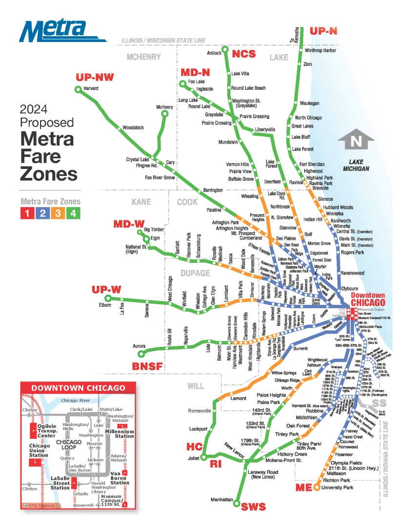
Metra Map Lines and Colour
| # | Line Name | Color | Route | Key Terminals |
|---|---|---|---|---|
| 1 | BNSF Railway Line | Orange | Union Station ➝ Aurora | Union Station (Chicago), Aurora |
| 2 | Union Pacific North (UP-N) | Dark Green | Ogilvie ➝ Kenosha | Ogilvie (Chicago), Kenosha (WI) |
| 3 | UP Northwest (UP-NW) | Blue | Ogilvie ➝ Harvard | Ogilvie (Chicago), Harvard |
| 4 | UP West (UP-W) | Yellow-Gold | Ogilvie ➝ Elburn | Ogilvie (Chicago), Elburn |
| 5 | Milwaukee District North | Light Green | Union Station ➝ Fox Lake | Union Station (Chicago), Fox Lake |
| 6 | Milwaukee District West | Pink | Union Station ➝ Elgin | Union Station (Chicago), Elgin |
| 7 | North Central Service | Purple | Union Station ➝ Antioch | Union Station (Chicago), Antioch |
| 8 | Heritage Corridor | Brown | Union Station ➝ Joliet | Union Station (Chicago), Joliet |
| 9 | Rock Island District | Red | LaSalle Street ➝ Joliet | LaSalle Street Station, Joliet |
| 10 | Metra Electric District | Teal | Millennium Station ➝ University Park | Millennium Station, University Park |
| 11 | SouthWest Service | Dark Purple | Union Station ➝ Manhattan | Union Station (Chicago), Manhattan |
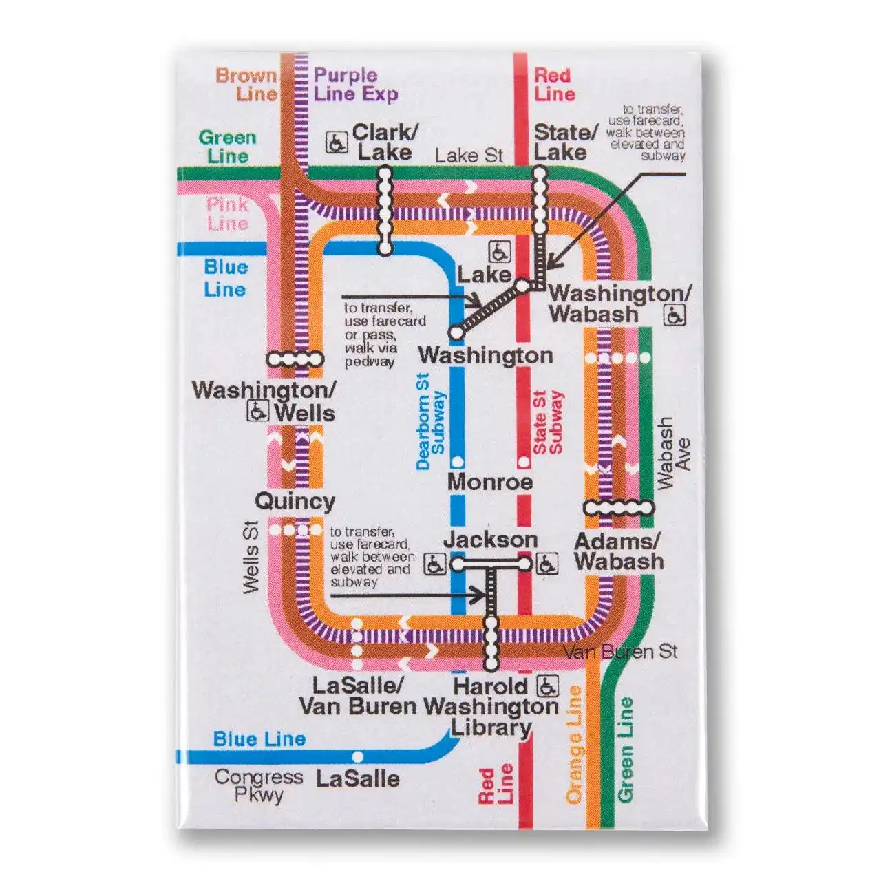
⚫ Chicago Loop Inset Map
- BNSF Railway Line (Orange) – Union Station to Aurora.
- Union Pacific North (Dark Green) – Ogilvie to Kenosha.
- Union Pacific Northwest (Blue) – Ogilvie to Harvard.
- Union Pacific West (Yellow-Gold) – Ogilvie to Elburn.
- Milwaukee District North (Light Green) – Union Station to Fox Lake.
- Milwaukee District West (Pink) – Union Station to Elgin.
- North Central Service (Purple) – Union Station to Antioch.
- Heritage Corridor (Brown) – Union Station to Joliet.
- Rock Island District (Red) – LaSalle Street Station to Joliet.
- Metra Electric District (Teal) – Millennium Station to University Park.
- SouthWest Service (Dark Purple) – Union Station to Manhattan.
 BNSF Railway Line (Orange) – Union Station to Aurora.
 Union Pacific Northwest (Blue) – Ogilvie to Harvard
 Union Pacific West (Yellow-Gold) – Ogilvie to Elburn
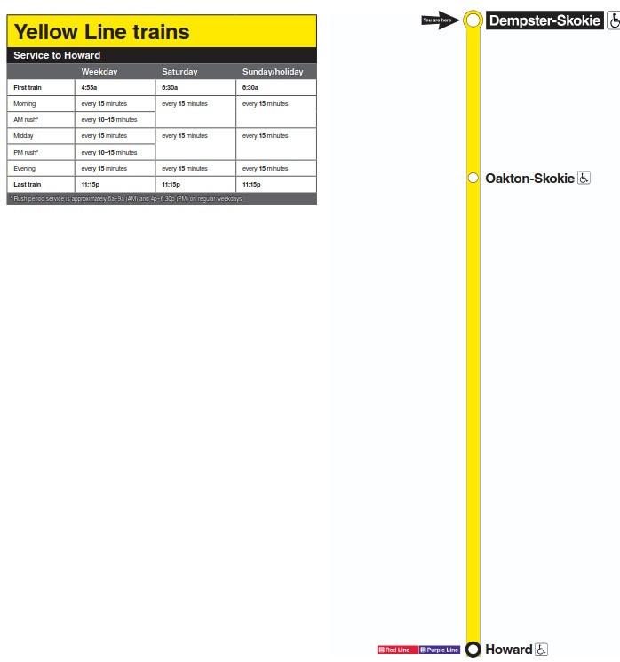
 Milwaukee District North (Light Green) – Union Station to Fox Lake.
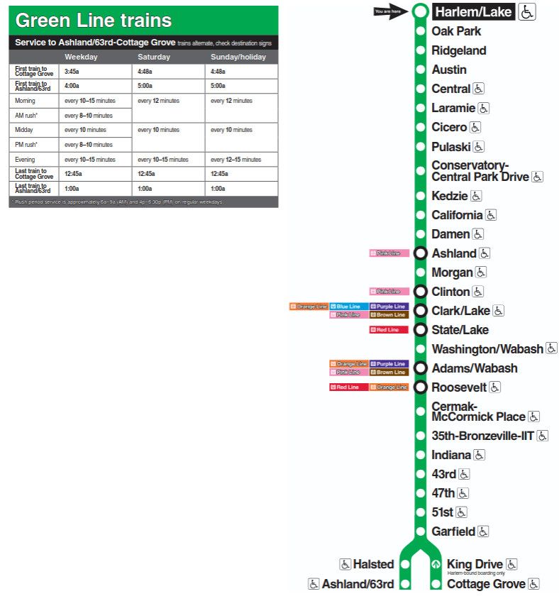
 Milwaukee District West (Pink) – Union Station to Elgin.
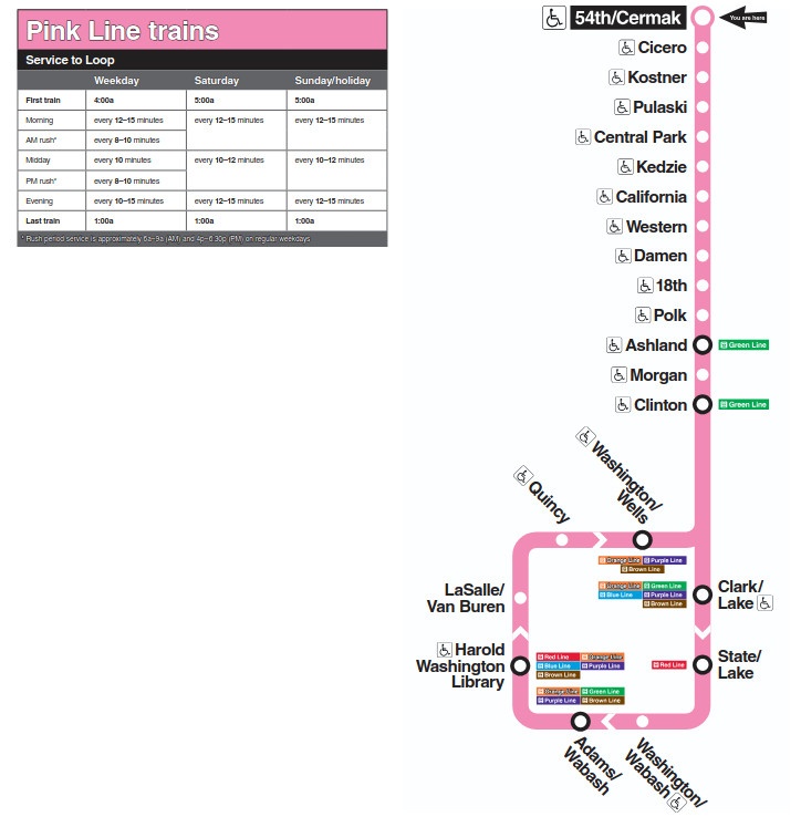
 North Central Service (Purple) – Union Station to Antioch
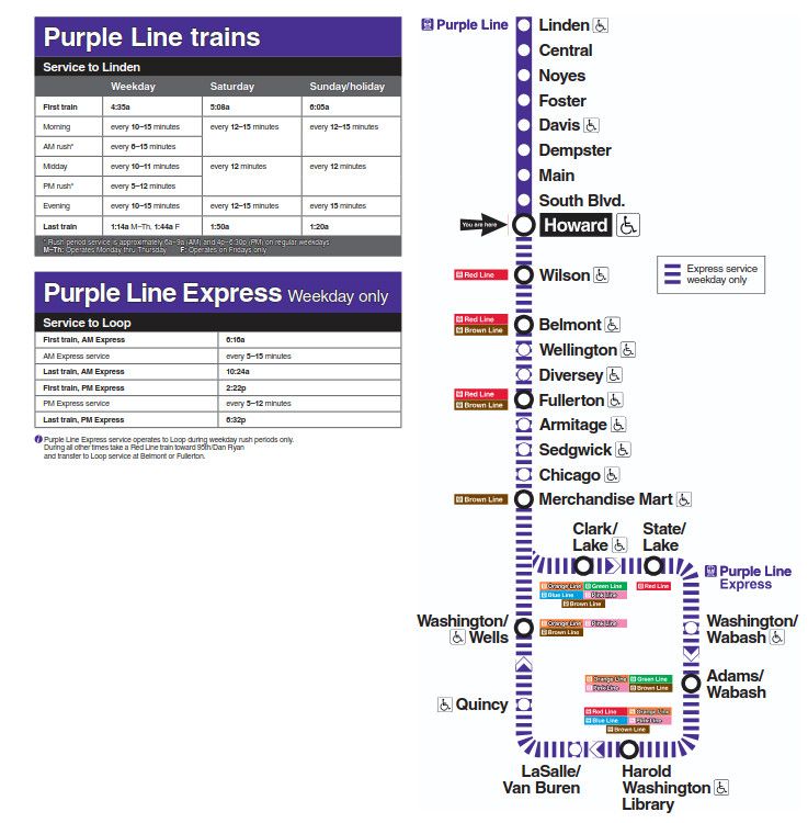
 Heritage Corridor (Brown) – Union Station to Joliet
 Rock Island District (Red) – LaSalle Street Station to Joliet
Metra Map Zones and Fare Calculation
Pricing Metra fares are calculated using a zone system based on modules (zones) of travel. Every station has a zone letter — starting with Zone A for downtown Chicago stations (such as Union Station, Ogilvie, and Millennium Station) and getting into higher zone letters like Zones B, C, D, and up as you head into the suburbs.
Fare is determined by the number of zones. As you pass through more zones, your fare will go up. For instance, a journey from Zone A (downtown) to Zone D (far outer suburb) is more expensive than a journey between Zone A and B.
The Metra Map is very obvious in labeling the station and its zone letter, to help you calculate your fare. To calculate the fare:
- Find your origin and destination stations.
- Identify their zone letters.
- Keep track of the number of zones you are passing through.
- You can pull the exact fare from Metra’s fare chart or app.
Metra Key Stations and Transfer Hubs
- Union Station: A central hub with multiple lines coming together. It also transfers passengers to intercity Amtrak services.
- Ogilvie Transportation Center: Other downtown terminus of several Union Pacific lines.
- Millennium Station: Important for the Metra Electric District, very near the lakefront and downtown.
- LaSalle Street Station: Rock Island District terminal.
- Joliet: Dunk‑point of utmost suburbia for many lines.
- Main transfer points: Where riders can make transfers from Metra to CTA (Chicago Transit Authority) trains or buses, or via Pace bus service, etc. These are important for multi‑modal commuters.
- Stations with special features: Big parking lots, ADA accessible stations, or just station houses/waiting rooms. So do major suburban stations, including Naperville and Elmhurst, which serve huge commuter populations.
You May Also Like
The Metra Map is a useful guide for understanding Chicago’s commuter rail network and the suburban communities it serves. Metra connects downtown Chicago with communities throughout northeastern Illinois through 11 rail lines and more than 240 stations.
Unlike the Chicago ‘L’ map, which primarily focuses on rapid transit within Chicago and nearby areas, the Metra system map covers a much larger suburban region. The network extends north toward Wisconsin, west toward communities such as Elburn, south toward University Park, and southwest toward Joliet and Manhattan.
Understanding the Metra rail map makes it easier to identify your train line, station, downtown terminal, transfer opportunities, and general direction of travel.
Metra Map at a Glance
| Feature | Details |
|---|---|
| Transit system | Metra commuter rail |
| Service region | Chicago and northeastern Illinois |
| Number of lines | 11 |
| Number of stations | 240+ |
| Downtown Chicago terminals | Union Station, Ogilvie Transportation Center, LaSalle Street Station, Millennium Station |
| Northern reach | Kenosha, Wisconsin |
| Northwestern reach | Harvard |
| Western reach | Elburn |
| Southwestern reach | Manhattan and Joliet |
| Southern reach | University Park |
| Major rail hubs | Chicago Union Station, Ogilvie Transportation Center, Millennium Station, LaSalle Street Station, Joliet |
| Related transit | CTA and Pace |
| Main map purpose | Route, station and line planning |
Metra’s New Riders information currently describes the system as having 11 lines and 243 stations serving Chicago and the six-county northeastern Illinois region.
The Metra map is a visual representation of Metra’s commuter rail network.
It shows the major rail lines, stations, downtown terminals, suburban destinations and the geographic relationship between different routes.
A Metra system map is especially helpful when you want to answer questions such as:
- Which Metra line serves my suburb?
- Which train goes to downtown Chicago?
- Which station is closest to my destination?
- Where does a particular Metra line end?
- Which lines use Union Station?
- Which lines use Ogilvie Transportation Center?
- How far does Metra extend outside Chicago?
- Can I connect between Metra lines?
- Which fare zone is my station located in?
Metra itself recommends using its system map or station finder when riders are unsure which station or line is closest to them.
Metra Rail Map: The 11 Lines
The Metra network is made up of 11 commuter rail lines.
| # | Metra Line | Downtown Chicago Terminal | General Direction | Outer Terminal |
|---|---|---|---|---|
| 1 | BNSF Railway | Union Station | West/Southwest | Aurora |
| 2 | Heritage Corridor | Union Station | Southwest | Joliet |
| 3 | Milwaukee District North | Union Station | North/Northwest | Fox Lake |
| 4 | Milwaukee District West | Union Station | West/Northwest | Elgin |
| 5 | North Central Service | Union Station | Northwest | Antioch |
| 6 | Rock Island | LaSalle Street Station | South/Southwest | Joliet |
| 7 | SouthWest Service | Union Station | Southwest | Manhattan |
| 8 | Metra Electric District | Millennium Station | South/Southeast | University Park |
| 9 | Union Pacific North | Ogilvie Transportation Center | North | Kenosha |
| 10 | Union Pacific Northwest | Ogilvie Transportation Center | Northwest | Harvard |
| 11 | Union Pacific West | Ogilvie Transportation Center | West | Elburn |
Metra’s current official materials identify these 11 lines and their general terminal destinations.
Metra Map and Chicago Downtown Terminals
One of the most important things to understand when reading a Metra map is that not every train uses the same downtown station.
Metra’s downtown services are divided among four major terminals.
1. Chicago Union Station
Union Station serves several Metra routes, including:
- BNSF Railway
- Heritage Corridor
- Milwaukee District North
- Milwaukee District West
- North Central Service
- SouthWest Service
It is also a major Amtrak hub.
2. Ogilvie Transportation Center
Ogilvie serves the three Union Pacific lines:
- Union Pacific North
- Union Pacific Northwest
- Union Pacific West
3. LaSalle Street Station
LaSalle Street Station is the downtown terminal for the:
- Rock Island District
4. Millennium Station
Millennium Station serves the:
- Metra Electric District
These downtown terminals are an important part of understanding the Metra Chicago map because choosing the wrong downtown station can result in boarding the wrong line.
Metra Map: North Side Lines
Several Metra lines extend north or northwest from downtown Chicago.
Union Pacific North
The Union Pacific North Line runs from Ogilvie Transportation Center toward Kenosha, Wisconsin.
Major communities and stations include:
- Rogers Park
- Evanston
- Wilmette
- Winnetka
- Highland Park
- Lake Forest
- Waukegan
- Zion
- Kenosha
Milwaukee District North
The Milwaukee District North Line travels north from Union Station toward Fox Lake.
It serves communities such as:
- Glenview
- Northbrook
- Deerfield
- Libertyville
- Grayslake
- Round Lake
- Fox Lake
North Central Service
The North Central Service travels northwest from Union Station toward Antioch.
Its route includes communities such as:
- Rosemont
- O’Hare area
- Schaumburg
- Hanover Park
- Elgin-area connections
- Antioch
The exact station pattern should be checked against the current timetable and system map.
Metra Map: Northwest Lines
The two primary Metra routes extending northwest are:
- Milwaukee District North
- Union Pacific Northwest
Union Pacific Northwest
The Union Pacific Northwest Line runs from Ogilvie Transportation Center toward Harvard.
Major communities include:
- Arlington Heights
- Palatine
- Barrington
- Crystal Lake
- Cary
- Woodstock
- Harvard
Milwaukee District North
The Milwaukee District North travels from Union Station toward Fox Lake.
Although both lines serve the northwest suburban region, they use different tracks and station networks.
Metra Map: West Lines
Metra has several routes serving western suburbs.
BNSF Railway
BNSF runs from Union Station toward Aurora.
Important stations include:
- Berwyn
- LaGrange
- Western Springs
- Hinsdale
- Downers Grove
- Lisle
- Naperville
- Aurora
Milwaukee District West
The Milwaukee District West runs from Union Station toward Elgin.
Major communities include:
- Franklin Park
- Elmwood Park
- Rosemont-area connections
- Roselle
- Bartlett
- Elgin
Union Pacific West
The Union Pacific West Line runs from Ogilvie Transportation Center toward Elburn.
Stations include communities such as:
- Elmhurst
- Lombard
- Wheaton
- West Chicago
- Geneva
- Elburn
The Metra map helps distinguish these western routes because several lines serve broadly similar suburban areas while using different downtown terminals.
Metra Map: Southwest Lines
The southwest portion of the Metra network includes several routes.
Heritage Corridor
The Heritage Corridor runs from Union Station to Joliet.
Key stations include:
- Summit
- Willow Springs
- Lemont
- Romeoville
- Lockport
- Joliet
SouthWest Service
The SouthWest Service runs from Union Station toward Manhattan.
It serves communities southwest of Chicago and follows a different route from the Heritage Corridor.
Rock Island
The Rock Island Line begins at LaSalle Street Station and provides service toward Joliet and other communities south and southwest of Chicago.
Because both Rock Island and Heritage Corridor reach Joliet, the Metra map is particularly useful for distinguishing their routes.
Metra Map: South Side Lines
The Metra Electric District is the major Metra route serving Chicago’s South Side and southern suburbs.
It begins at Millennium Station and extends south toward University Park, with branches and stations serving communities in the southern part of the region.
Important destinations include:
- Museum Campus/11th Street
- 18th Street
- McCormick Place
- 51st/53rd Street
- 59th/60th Street
- 95th Street
- Homewood
- Flossmoor
- Olympia Fields
- Matteson
- University Park
The Metra Electric District is particularly different from many other Metra lines because it uses an electric rail operation.
Metra Map: Far South and Southwest
The southern and southwestern edges of the Metra network include:
- University Park
- Manhattan
- Joliet
- Elburn
- Aurora
The map shows how these lines radiate outward from downtown Chicago.
For example:
Millennium Station → University Park
is served by the Metra Electric District, while:
Union Station → Joliet
can be served by the Heritage Corridor, and:
LaSalle Street Station → Joliet
is served by Rock Island.
This illustrates why knowing the line name and downtown terminal is important.
Metra Stations Map
Metra has more than 240 stations across its network.
Stations range from major downtown terminals to smaller suburban stops.
Some important Metra stations include:
| Station | Lines/Service |
|---|---|
| Chicago Union Station | Multiple Metra lines |
| Ogilvie Transportation Center | Union Pacific lines |
| Millennium Station | Metra Electric |
| LaSalle Street Station | Rock Island |
| Joliet | Heritage Corridor and Rock Island |
| Aurora | BNSF |
| Elgin | Milwaukee District West / related connections |
| Elburn | Union Pacific West |
| Harvard | Union Pacific Northwest |
| Kenosha | Union Pacific North |
| Fox Lake | Milwaukee District North |
| Antioch | North Central Service |
| University Park | Metra Electric |
| Manhattan | SouthWest Service |
Metra Map and Fare Zones
The Metra map is also useful for understanding fare zones.
Metra fares are based on the number of fare zones traveled. Metra’s rider information explains that fares depend on the zones through which a passenger travels.
For example, a passenger traveling between a suburban station and downtown Chicago may travel through several zones.
Understanding fare zones
| Trip Type | What to Check |
|---|---|
| Suburb to Chicago | Origin zone + Zone 1 |
| Suburb to suburb | Origin and destination zones |
| Chicago to another suburb | Zone 1 + destination zone |
| Multi-zone trip | Applicable fare-zone combination |
| Reduced fare | Eligibility requirements |
| Weekend travel | Applicable day/weekend pass |
Because fares can change, use Metra’s current fare calculator for the exact price rather than relying solely on a static map.
Metra Map vs. CTA Map
The Metra map and CTA map serve different purposes.
| Feature | Metra | CTA |
|---|---|---|
| Main service type | Commuter rail | Rapid transit and city buses |
| Primary coverage | Chicago + suburbs | Chicago + nearby areas |
| Long-distance suburban travel | Yes | Limited |
| Downtown stations | Major rail terminals | Numerous downtown ‘L’ stations |
| Service pattern | Scheduled commuter trains | More frequent urban transit |
| Suburban reach | Extensive | More limited |
| Best use | Suburban-to-Chicago travel | City and neighborhood travel |
Metra, CTA and Pace also work together as part of the region’s broader public transportation network. Metra’s new-rider information specifically notes that trip planning may recommend CTA and Pace connections in addition to Metra.
Metra Map and Pace Connections
Metra stations frequently connect with Pace suburban buses.
These connections are useful for passengers whose final destination is not within walking distance of a Metra station.
A typical trip might look like:
Suburban home → Pace bus → Metra station → Metra train → Chicago → CTA
or:
Chicago → Metra → suburban station → Pace bus → final destination
This is why looking at the Metra map together with regional transit information can be more useful than viewing the railroad network alone.
How to Read a Metra Map
If you are looking at a Metra system map for the first time, follow these steps.
Step 1: Find your starting location
Locate your neighborhood, suburb or nearby station.
Step 2: Identify the closest Metra station
If you are unsure, Metra provides a station finder that can help identify nearby stations.
Step 3: Identify the line
Look at the line name or abbreviation associated with the station.
Step 4: Find your destination
Locate the station closest to your destination.
Step 5: Follow the route
Trace the line between your starting station and destination.
Step 6: Check the downtown terminal
If your trip involves Chicago, identify whether you need:
- Union Station
- Ogilvie Transportation Center
- LaSalle Street Station
- Millennium Station
Step 7: Check the schedule
The map tells you where the train goes, while the timetable tells you when the train runs.
Step 8: Check fares
Use the current Metra fare information for the exact trip.
Metra Map: Downtown Chicago Connections
Downtown Chicago is the center of the Metra network.
The major terminals are positioned relatively close to one another, allowing passengers to connect with other public transportation services.
| Downtown Terminal | Main Metra Lines |
|---|---|
| Union Station | BNSF, Heritage Corridor, Milwaukee District North, Milwaukee District West, North Central Service, SouthWest Service |
| Ogilvie Transportation Center | Union Pacific North, Union Pacific Northwest, Union Pacific West |
| LaSalle Street Station | Rock Island |
| Millennium Station | Metra Electric |
These four terminals should be treated as separate destinations when planning a trip.
Metra Map: Major Outer Terminals
The outer terminals demonstrate how far the commuter rail system extends from Chicago.
| Direction | Example Terminal | Line |
|---|---|---|
| North | Kenosha | Union Pacific North |
| Northwest | Harvard | Union Pacific Northwest |
| West | Elburn | Union Pacific West |
| West/Southwest | Aurora | BNSF |
| Northwest | Elgin | Milwaukee District West |
| North | Fox Lake | Milwaukee District North |
| Northwest | Antioch | North Central Service |
| Southwest | Joliet | Heritage Corridor |
| Southwest | Joliet | Rock Island |
| Southwest | Manhattan | SouthWest Service |
| South | University Park | Metra Electric |
The Metra network therefore extends well beyond Chicago city limits.
Metra Map and Joliet
Joliet is one of the most important suburban points on the Metra map because it is served by more than one Metra line.
The two major Metra services serving Joliet are:
- Heritage Corridor
- Rock Island
However, these lines have different downtown Chicago terminals and different schedules.
This makes Joliet an excellent example of why travelers should look at the full route instead of simply searching for a station name.
Metra Map and O’Hare Airport
Metra does not operate a train directly into an airport terminal at O’Hare in the same way that the CTA Blue Line does.
However, the North Central Service serves the O’Hare Transfer station, which provides an option for connecting between Metra and airport-area transportation.
Metra’s new-rider information also emphasizes that trip planning can combine Metra with CTA and Pace services.
For an airport trip, always check the current connection and allow additional time for transfers.
Metra Map for Tourists
Visitors to Chicago can use the Metra map when traveling outside the central city.
Metra can be useful for reaching suburban destinations such as:
- Evanston
- Highland Park
- Lake Forest
- Arlington Heights
- Naperville
- Geneva
- Aurora
- Joliet
- Elgin
- Kenosha
For visitors staying in downtown Chicago, the first step is usually identifying which downtown terminal serves the destination.
Metra Map for Daily Commuters
For regular commuters, the map helps identify:
- Closest station
- Correct rail line
- Downtown terminal
- Connecting CTA routes
- Pace connections
- Alternative stations
- Possible transfer points
However, commuters should use the map together with the current schedule because a map does not show individual departure times.
Metra Map and Train Schedules
The Metra map and Metra schedule serve two different purposes.
| Tool | Purpose |
|---|---|
| Metra Map | Shows where lines and stations are located |
| Metra Schedule | Shows when trains depart and arrive |
| Metra Fare Calculator | Shows applicable fares |
| Station Finder | Helps identify nearby stations |
| Trip Planner | Helps plan a complete journey |
| Train Tracker | Provides real-time train information |
Metra recommends using its trip planner when riders are unfamiliar with the system and its schedule tool when they already know their origin and destination stations.
Is There One Metra Map for Every Line?
Yes, Metra has a system map showing the overall rail network, while individual line schedules and station information provide more detailed information for specific routes.
A system map is useful for seeing the entire network at once.
For detailed trip planning, however, you should combine the map with:
- Current line timetable
- Station information
- Fare information
- Service alerts
- Real-time train status
Metra Map Abbreviations
You may see abbreviations on Metra maps, schedules and other transit information.
| Abbreviation | Meaning |
|---|---|
| BNSF | BNSF Railway |
| HC | Heritage Corridor |
| MD-N | Milwaukee District North |
| MD-W | Milwaukee District West |
| NCS | North Central Service |
| RI | Rock Island |
| SWS | SouthWest Service |
| ME | Metra Electric |
| UP-N | Union Pacific North |
| UP-NW | Union Pacific Northwest |
| UP-W | Union Pacific West |
Metra Map and Accessibility
Accessibility is an important consideration when choosing a station.
Metra provides accessibility information for individual stations, including information about accessible platforms and station facilities.
When planning an accessible journey, do not rely solely on the map symbol. Check the current station information and, when necessary, contact Metra before traveling.
Metra’s rider information also states that customers with mobility devices and service animals are welcome on Metra lines.
Metra Map for First-Time Riders
If you have never used Metra before, the network can initially look complicated because multiple lines leave downtown Chicago in different directions.
A simple approach is:
Find station → Find line → Find downtown terminal → Check schedule → Check fare → Board train
For example, if your destination is Naperville:
- Find Naperville on the map.
- Identify the BNSF Railway Line.
- Note that BNSF uses Union Station.
- Check the BNSF schedule.
- Confirm the fare.
- Travel to Union Station.
- Board the correct BNSF train.
This approach works for most Metra journeys.
Metra System Map: Quick Reference
| You Want to Travel To | Metra Line to Check | Chicago Terminal |
|---|---|---|
| Aurora | BNSF | Union Station |
| Joliet | Heritage Corridor / Rock Island | Union Station / LaSalle Street |
| Manhattan | SouthWest Service | Union Station |
| University Park | Metra Electric | Millennium Station |
| Kenosha | Union Pacific North | Ogilvie |
| Harvard | Union Pacific Northwest | Ogilvie |
| Elburn | Union Pacific West | Ogilvie |
| Fox Lake | Milwaukee District North | Union Station |
| Elgin | Milwaukee District West | Union Station |
| Antioch | North Central Service | Union Station |
Tips for Using the Metra Map
Use the map to understand the network
Do not use a system map as a substitute for a timetable.
Check your line carefully
Several Metra routes serve broadly similar geographic areas but have different stations.
Remember the four downtown terminals
Union Station, Ogilvie, LaSalle Street Station and Millennium Station serve different lines.
Check the direction
Make sure the train is heading toward your destination.
Check the exact station
Some trains may have different stopping patterns or schedules.
Check current information
Construction and other service changes can affect normal operations.
Use the trip planner
Metra recommends its trip-planning tools for riders who are unsure which line or station to use.
Frequently Asked Questions
What is the Metra map?
The Metra map shows Chicago’s commuter rail network, including its 11 lines, stations, downtown terminals and suburban destinations.
How many Metra lines are there?
Metra currently operates 11 rail lines.
How many stations does Metra have?
Metra’s current new-rider information lists 243 stations across its system.
What are the main Metra downtown stations?
The four major downtown terminals are:
- Chicago Union Station
- Ogilvie Transportation Center
- LaSalle Street Station
- Millennium Station
Which Metra lines use Union Station?
Union Station serves:
- BNSF
- Heritage Corridor
- Milwaukee District North
- Milwaukee District West
- North Central Service
- SouthWest Service
Which Metra lines use Ogilvie?
Ogilvie Transportation Center serves:
- Union Pacific North
- Union Pacific Northwest
- Union Pacific West
Which Metra line uses LaSalle Street Station?
The Rock Island District uses LaSalle Street Station.
Which Metra line uses Millennium Station?
The Metra Electric District uses Millennium Station.
Does Metra go to Joliet?
Yes. Joliet is served by the Heritage Corridor and Rock Island lines.
Does Metra go to Aurora?
Yes. Aurora is served by the BNSF Railway Line.
Does Metra go to Kenosha?
Yes. The Union Pacific North Line extends to Kenosha, Wisconsin.
Does Metra go to Elburn?
Yes. Elburn is the western terminal of the Union Pacific West Line.
Does Metra go to University Park?
Yes. University Park is served by the Metra Electric District.
Does Metra go to Harvard?
Yes. Harvard is served by the Union Pacific Northwest Line.
Can I use the Metra map to find the closest station?
Yes. Metra recommends its system map and station finder for identifying nearby stations and lines.
Does the Metra map show train times?
The system map primarily shows the network and stations. Use Metra’s schedule tool for exact departure and arrival times.
Does the Metra map show fares?
Metra provides fare-zone information separately. The applicable fare depends on the zones traveled.
Final Takeaway
The Metra Map provides a complete overview of Chicago’s commuter rail network, connecting downtown Chicago with hundreds of suburban stations across northeastern Illinois and extending into Wisconsin.
The system has 11 rail lines and 243 stations, with four major downtown terminals: Chicago Union Station, Ogilvie Transportation Center, LaSalle Street Station, and Millennium Station.
The easiest way to use the map is to first identify your starting station and destination, then determine the appropriate Metra line and downtown terminal. After that, check the current schedule, fare information and service alerts before traveling.